

National Public Toilet Map app for iPhone and iPad
Developer: Human Solutions Pty Ltd
First release : 02 Aug 2009
App size: 7.24 Mb
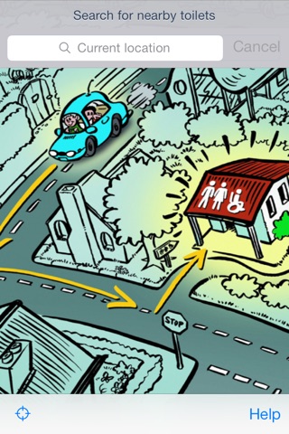
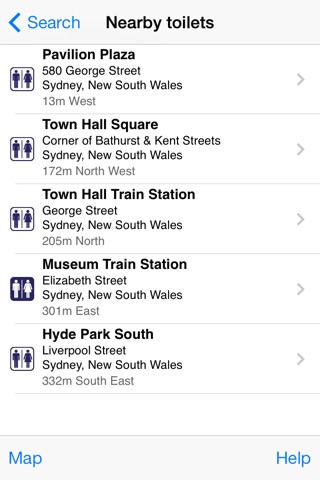
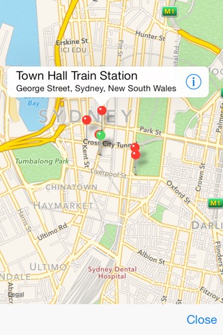
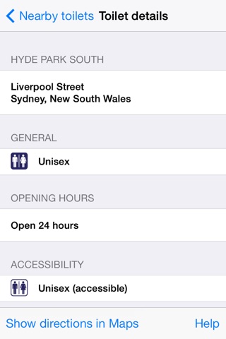
The National Public Toilet Map shows the location of more than 23,000 public and publicly available private facilities across Australia, including toilets, adult change and baby care. Information is provided about each facility, such as location, accessibility details, opening hours and features like hoists, sharps disposal and showers.
The Toilet Map improves independence and quality of life for the estimated 4.8 million Australians who are affected by incontinence. It is also convenient for people with young families and those holidaying or travelling to new locations.
The Toilet Map is funded by the Australian Government Department of Health and Aged Care as part of the National Continence Program and is managed through the Continence Foundation of Australia.
If you have any queries, concerns or require further information relating to the National Public Toilet Map, please contact us via the link on the App Store.
Disclaimer:
The Commonwealth Department of Health and Aged Care makes every effort to ensure the quality of the information used in the Toilet Map and updates the information regularly. Before relying on the information, users should carefully evaluate its accuracy, currency, completeness and relevance for their purposes. The Commonwealth Department of Health and Aged Care cannot guarantee and assumes no legal liability or responsibility for the accuracy, currency or completeness of the information and does not accept any liability for any injury, loss or damage incurred by use of or reliance on the information.